(The Japanese version of this page is here.)
Objective of India Place Finder
India Place Finder* is a tool to find geographic information from any alphabetical toponym in India. Each toponym (place-name) changes through history, and the English transcription is not unique. Even toponyms from academic works are not always accurate. This system considers notation fluctuations and helps you to retrieve the appropriate information from any toponym through "similar-search method". It also displays her location on the map.
You can search any place names, from around 600 thousands villages recorded in the 2001 Census of India, and around 6 thousands locality names in the towns in Census mode, or from around 900 thousands hamlets (natural villages) in Hamlet mode. You can sort them and narrow them down by state, district or sub-district.
Currentry, locality names from the following towns can be traced.
Pondicherry, Mysore, Dakshina Kannanda, Madurai, Kachipuram, Hyderabad, Hubli-Dharwad, Chennai, Belgaum, Gangalore.
How to Use India Place Finder
1. Single Mode
Single Mode is to get the information of a single toponym. Click "Single Mode" on the top.
 Enter the toponym in the query form (see right) and press "retrieve" button.
It is not case-sensitive.
 - The candidate flags appear over the map, and the corresponding list appears on the right side.
- Manipulate the scale bar to zoom the map.
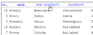 Sorting the candidates on the list by state, district or sub-district
can be done by just clicking the corresponding column name.
 - To narrow down the candidates within a state, district or sub-district, select the relevant item from the query form which begins with (all states) or (all districts) or (all sub-districts). Press the "retrieve" button again.
- Clicking the candidate makes the corresponding marker appear on the map.
- Clicking the marker makes the corresponding candidate change colors.
- Now you can copy and paste the location code and other coordinates as you select.
2. CSV Mode (for a list of toponyms)
CSV Mode is for a user who want to get information for multiple toponyms. To select this mode, click "CSV Mode" on the top. The system can retrieve the name of state, district, sub-district, Census location code and other coordinates of each toponym in your list.
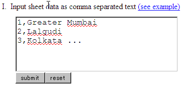 At the text box titled "I. Input sheet data as comma separated text" (see right),
enter the toponym list in the CSV format as below:
1,Pune
2,Mumbai
3,Delhi
Then press the "submit" button.- The first column is just for identification. You can use any your favorite numbers and alphabets.
- The second column should be the toponyms you need to identify the location and other information.
-
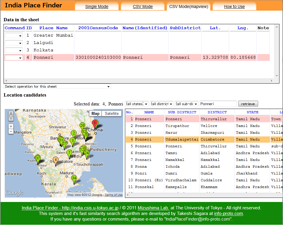 A new page "CSV Mode(mapview)" will automatically open.
The upper half is the registered toponym list, called "Data in the sheet",
and the lower half is the map with the candidate list called "Location candidates".
We call the registered toponyms list in CSV format as "sheet" throughout.
- Click any toponym in the sheet (e.g. Ponneri), then the corresponding list of candidates appears in the lower right.
- Select exact place in a similar way as Single Mode.
- Double-click the selected line in the list, then the information will be inserted in the toponym list.
- Repeat the same sequence for each of the toponyms (for example, Lalgudi, Kolkata).
- The result can be downloaded as a CSV file. Select "Save sheet".
3. CSV Mode (using toponym list from spreadsheet)
To process many toponyms quickly, a CSV file is useful. Use Microsoft Excel or other spreadsheet software to produce CSV files.
- Open a spreadsheet software like Excel. Then enter numbers 1,2,3.. on the first column, and the corresponding toponyms on the second column. You can also add other information after the third column.
- Save the file in a CSV format file.
- Then go back to the India Place Finder software, click "CSV mode" on the top.
- Click "Browse..." (or "Choose...", "Choose File" in some browsers) button in "II. Upload sheet file". Neglect all values in I and III.
- Select the CSV file you prepared above, and click "submit" button.
- A new page "CSV Mode(mapview)" automatically opens. Follow the procedure explained above in "2. CSV Mode (for a list of typonyms)".
Useful Hints
Saving temporary files while processing in CSV Mode
Massive toponyms can be processed by CSV mode, but you might mistakenly lose anything just by closing the browser. We recommend you to save the outputs as often as possible. For those who want to save the file temporarily, the following method may be convenient.
- Select "Save sheet temporarily" option below the toponym list.
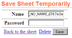 Enter your sheet name and the password after "Save Sheet Temporarily" form
(shown right) appears. Then press "Save" button.
 - You cannot use the file name that anyone else uses.
- You cannot open the sheet if you forget the password.
- Each sheet is also automatically deleted after 30 days if not opened.
- To open a temporary saved sheet, enter the name and the password of the sheet in "III. Retrieve temporarily saved sheet" in CSV Mode screen, and press "submit" button.
How to display the map in non-English
To display the map in non-English languages like Japanese or Chinese, set the preference order of languages of the browser properly as below.
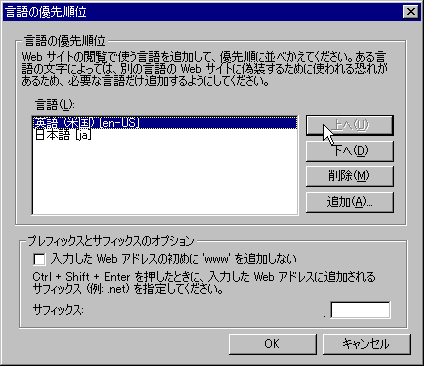 Internet Explorer :
refer to
"Change-your-Internet-Explorer-language-settings (Microsoft)".
Internet Explorer :
refer to
"Change-your-Internet-Explorer-language-settings (Microsoft)".- Firefox : refer to "Options window - Content panel (mozilla.org)".
- Google Chrome : refer to "Fonts, languages, and encodings : Basic browser settings (Google)"

 .
.